Extreme Rain – What It Means and How to Stay Safe
When talking about extreme rain, heavy downpours that exceed normal thresholds and often cause rapid flooding. Also known as intense rainfall, it can turn ordinary streets into rivers within minutes. Below we break down the main pieces of the puzzle so you know what to expect when the sky opens up.
Why Floods Follow Extreme Rain
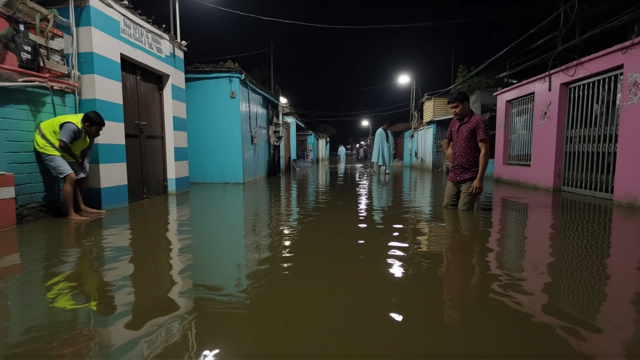
Extreme rain encompasses flooding, the overflow of water onto normally dry land. Floods demand quick action because they can damage property, disrupt transport and threaten lives. In many Indian towns, like Mathura, floodwaters have risen above 167 meters, forcing local authorities to halt classes and launch rescue operations. Watching the water rise teaches a simple rule: the faster the rain, the sooner the flood.
Close monitoring of river levels, the height of water in a river measured against a standard gauge is the backbone of flood prediction. When heavy rain pours into a basin, the river level spikes, often breaching safety limits within hours. The Yamuna River, for example, hit 167.64 m during a recent extreme rain event, prompting officials to issue alerts and close schools. River‑level data feeds directly into warning systems, giving communities precious minutes to react.
When schools shut down, the ripple effect reaches families, businesses and emergency crews. Disaster relief, organized aid that includes shelter, food and medical help steps in to fill the gap. Relief teams set up temporary shelters, distribute dry clothing and coordinate rescue boats. Their presence often determines how quickly students can return to class once waters recede. In Mathura, relief workers cleared debris and pumped water out of classrooms, allowing a gradual reopening.
Effective emergency response, the coordinated actions of police, fire, health and volunteer groups during a crisis hinges on accurate weather forecasting. Forecast models predict where extreme rain will strike, letting responders pre‑position resources. The better the forecast, the faster the response, and the lower the human and economic cost.
Long‑term, climate change, the shift in global weather patterns caused by greenhouse‑gas emissions is amplifying the frequency and intensity of extreme rain. Warmer air holds more moisture, so storms dump more water in shorter periods. Communities that adapt now—by building higher levees, improving drainage and investing in early‑warning tech—will face fewer catastrophes later.
All these pieces—heavy rain, river‑level spikes, flooding, school closures and relief efforts—form a linked chain that determines how a community copes. Below you’ll find the latest posts that track real‑time river data, report on school status, and outline emergency measures during extreme rain events. Dive in to see the full picture and stay a step ahead when the clouds gather.
IMD Alerts Extreme Rainfall in Odisha, Telangana, Konkan & Goa (Sept 26‑30, 2025)
IMD warns of extremely heavy rain in Odisha, Telangana, Konkan & Goa from Sept 26‑30, 2025, urging evacuations, farmer precautions, and travel alerts.